- Show All
- Land Cover
- Forest
- Dashboard
- Tools
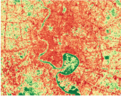
Regional Land Cover Monitoring System
The regional land cover monitoring system (RCLMS) provides a series of 30-m resolution annual land cover maps with a multi-purpose typology for the years 2000-2016. These regional land cover maps are highly accurate and are designed to serve explicit user-defined objectives. Other features of these maps include:
- High levels of consistency over time, achieved using a consistent regional classification scheme that harmonizes the land cover typologies from five Lower Mekong countries;
- Twenty-two (22) land cover categories, identified through regional consultative meetings;
- Annual or bi-annual updates, which leverage openly available remote sensing data sources;
- Stakeholder-driven classification supports high levels of accuracy and allows for customization.
The purpose of the RLCMS is to facilitate the production of custom, high-quality land cover information products to serve a variety of policy, planning, management, and reporting needs of regional and national institutions in the Lower Mekong Region. The system leverages the power of Google Earth Engine and relies in most cases on field observations and the interpretation of high resolution imagery by stakeholders relevant to a given project. Once the system has been customized to deliver a given product or set of products, these can be updated regularly in a structured manner to serve ongoing monitoring needs.
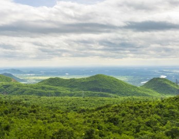
Forest Monitoring
The forest monitoring system is a product of the collaboration between SERVIR-Mekong and the Global Land Analysis and Discovery Lab (GLAD) from University of Maryland. The tool allows users to view and download raster maps of annual tree canopy cover percentage and, annual tree height, and to create binary annual forest extent maps by customizing the country’s forest definition. Users can also calculate key forest dynamics, including forest gain and loss, by customizing forest definition and the change period.

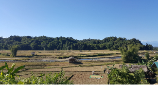
Myanmar National Land Cover Portal
SERVIR-Mekong and partners are collaborating with and supporting the Forest Department of Myanmar to improve the forest monitoring system of Myanmar. The forest monitoring system contributes to the Myanmar National Forest Resources Assessment (FRA) for FAO. For this project, the RLCMS is customized to meet the forest types definition in Myanmar. The product of this application are forest maps with forest categories and sub categories. Forest map products are from 2000 to 2016. The uncertainty and accuracy data assessment is integrated in the assemblage and map results.
Myanmar National IPCC
SERVIR-Mekong and partners are collaborating with and supporting the Forest Department of Myanmar to improve the land cover monitoring system which contributes to the greenhouse gas emission inventory, climate change monitoring and reporting to the United Nations Climate Change (UNFCCC) by the government of Myanmar. This customized product is a robust and sustainable national land cover monitoring system which can produce accurate LULC baseline datasets, and be updated annually for Myanmar's contribution to UNFCCC report. Products of this application are annual land cover maps with 6 IPCC typologies classes (including forest land, cropland, grassland, wetland) from 2000 to 2016. Activity data of 6 land cover categories will also be calculated in this application at different administrative levels.
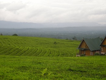
Myanmar Plantation Mapping
The Dawna Tenasserim Landscape covers Kayin and Mon States, and Tanintharyi Region in Myanmar. The area harbours one of the last large intact forest landscapes in the region, a large number of ethnic groups, and a wide variety of endangered wildlife such as elephants and tigers. The region is experiencing numerous threats including rapid increase in agricultural land use and associated deforestation, notably for rubber and palm oil, road and infrastructure development, and logging resulting in habitat degradation and fragmentation. The Dawna Tenasserim plantation portal shows areas with cropland, rubber, and palm oil for 2017 and 2018. Remote Sens. 2019, 11(7), 831; https://doi.org/10.3390/rs11070831

Statistical Analysis

Collect Earth Online
Collect Earth Online is a custom built, open-source, high resolution satellite image viewing and interpretation system that is being developed by SERVIR-Mekong as a tool for use in projects that require land cover and/or land use reference data. Collect Earth Online promotes consistency in locating, interpreting, and labeling reference data plots for use in classifying and monitoring land cover / land use change. The full functionality of Collect Earth Online including compilation of reference point databases is implemented online so there is no need for desktop installation.
SEPAL
SEPAL allows users to query and process satellite data quickly and efficiently, tailor their products for local needs, and produce sophisticated and relevant geospatial analyses quickly. Harnessing cloud-based supercomputers and modern geospatial data infrastructures (e.g. Google Earth Engine), SEPAL enables access and processing of historical satellite data as well as newer data from Landsat and higher-resolution data from Europe's Copernicus programme.