- Show All
- Land Cover
- Forest
- Dashboard
- Tools
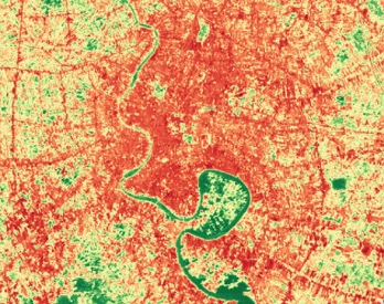
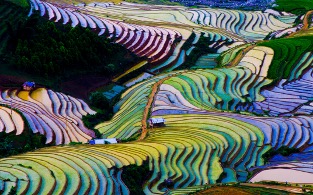
Regional Land Cover Monitoring System
The regional land cover monitoring system (RCLMS) provides a series of 30-m resolution annual land cover maps with a multi-purpose typology for the years 2000-2016. These regional land cover maps are highly accurate and are designed to serve explicit user-defined objectives. Other features of these maps include:
- High levels of consistency over time, achieved using a consistent regional classification scheme that harmonizes the land cover typologies;
- Twenty-two (22) land cover categories, identified through regional consultative meetings;
- Annual or bi-annual updates, which leverage openly available remote sensing data sources;
- Stakeholder-driven classification supports high levels of accuracy and allows for customization.
The purpose of the RLCMS is to facilitate the production of custom, high-quality land cover information products to serve a variety of policy, planning, management, and reporting needs of regional and national institutions in the South East Asia. The system leverages the power of Google Earth Engine and relies in most cases on field observations and the interpretation of high resolution imagery by stakeholders relevant to a given project. Once the system has been customized to deliver a given product or set of products, these can be updated regularly in a structured manner to serve ongoing monitoring needs.
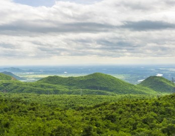
Forest Monitoring
The forest monitoring system is a product of the collaboration between SERVIR-SEA and the Global Land Analysis and Discovery Lab (GLAD) from University of Maryland. The tool allows users to view and download raster maps of annual tree canopy cover percentage and, annual tree height, and to create binary annual forest extent maps by customizing the country’s forest definition. Users can also calculate key forest dynamics, including forest gain and loss, by customizing forest definition and the change period. This tool extends the forest cover maps to Philippines and Indonesia since 2020.

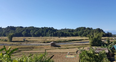
Myanmar Land and Agriculture Monitoring Project (LAMP)
The Myanmar Land and Agriculture Monitoring Project (LAMP) is an open-access, web-based tool designed to monitor the performance of landscape-scale efforts and biophysical conditions on-the-ground in Myanmar. The core features of this tool include maps, charts, and descriptive information to track various environmental parameters critical to environmental protection and safeguarding.

Collect Earth Online
Collect Earth Online is a custom built, open-source, high resolution satellite image viewing and interpretation system that is being developed by SERVIR-SEA as a tool for use in projects that require land cover and/or land use reference data. Collect Earth Online promotes consistency in locating, interpreting, and labeling reference data plots for use in classifying and monitoring land cover / land use change. The full functionality of Collect Earth Online including compilation of reference point databases is implemented online so there is no need for desktop installation.
SEPAL
SEPAL allows users to query and process satellite data quickly and efficiently, tailor their products for local needs, and produce sophisticated and relevant geospatial analyses quickly. Harnessing cloud-based supercomputers and modern geospatial data infrastructures (e.g. Google Earth Engine), SEPAL enables access and processing of historical satellite data as well as newer data from Landsat and higher-resolution data from Europe's Copernicus programme.